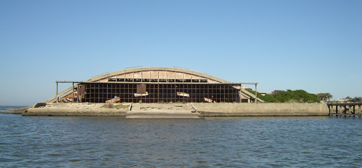
Natural feature nearby Isla del La Libertad
Coronavirus disease (COVID-19) Situation
confirmed cases
1041111
deaths
7664
Uruguay
Natural feature nearby Isla del La Libertad
Isla del La Libertad
Montevideo Uruguay
contacts phone
:
+598
Latitude:
-34.8888732
, Longitude:
-56.2339109
read more
nearest Natural feature
618 m
Roca La Teja
Montevideo
Natural feature
read more
618 m
Cerro de las Espinas
Montevideo
Natural feature
read more
618 m
Roca Rio Negro
Montevideo
Natural feature
read more
956 m
Isla Humphreys
Montevideo
Natural feature
read more
1.238 km
Piedra Redonda
Montevideo
Natural feature
read more
1.238 km
Roca Sabina
Montevideo
Natural feature
read more
1.253 km
Montevideo Bay
Montevideo
Natural feature
read more
1.253 km
Bahía de Montevideo
Montevideo
Natural feature
read more
1.426 km
Isla Del Bizcochero
Montevideo
Natural feature
read more
1.689 km
Roca El Ombu
Montevideo
Natural feature
read more
1.689 km
Piedras de Capurro
Montevideo
Natural feature
read more
1.962 km
Playa del Cerro
Montevideo
Natural feature
read more
2.202 km
Cerro de Montevideo
Montevideo
Natural feature
read more
2.675 km
Piedra Fieramosca
Montevideo
Natural feature
read more
2.919 km
Arroyo Miguelete
Montevideo
Natural feature
read more
2.919 km
Miguelete Creek
Montevideo
Natural feature
read more
3.317 km
Plaza Jerónimo Eustache (Pistoleta)
Montevideo
Natural feature
read more
3.354 km
Plaza José Herrera y Sotomayor
Montevideo
Natural feature
read more
3.404 km
Plaza Alonso de la Vega
Montevideo
Natural feature
read more
3.421 km
Roca Tagus
Uruguay
Natural feature
read more
3.432 km
Plaza San Felipe y Santiago
Montevideo
Natural feature
read more
3.487 km
Plaza Manuel Cipriano de Melo
Montevideo
Natural feature
read more
3.538 km
Plaza del Recinto
Montevideo
Natural feature
read more
3.665 km
Playa del Nacional
Montevideo
Natural feature
read more
5.847 km
Parque Andalucía
Montevideo
Natural feature
read more
📑
all categories
Accounting
Administrative area level 1
Administrative area level 2
Airport
Amusement park
Aquarium
Art gallery
Atm
Bakery
Bank
Bar
Beauty salon
Bicycle store
Book store
Bowling alley
Bus station
Cafe
Campground
Car dealer
Car rental
Car repair
Car wash
Casino
Cemetery
Church
City hall
Clothing store
Colloquial area
Convenience store
Courthouse
Dentist
Department store
Doctor
Electrician
Electronics store
Embassy
Finance
Fire station
Florist
Food
Funeral home
Furniture store
Gas station
General contractor
Grocery or supermarket
Gym
Hair care
Hardware store
Health
Hindu Temple
Home goods store
Hospital
Insurance agency
Intersection
Jewelry store
Laundry
Lawyer
Library
Liquor store
Local government office
Locality
Locksmith
Lodging
Meal delivery
Meal takeaway
Mosque
Movie rental
Movie theater
Moving company
Museum
Natural feature
Neighborhood
Night club
Painter
Park
Parking
Pet store
Pharmacy
Physiotherapist
Place of worship
Plumber
Point of interest
Police
Political
Post office
Premise
Real estate agency
Restaurant
Roofing contractor
Route
Rv park, camping
School
Shoe store
Shopping mall
Spa
Stadium
Storage
Store
Subpremise
Supermarket
Synagogue
Taxi stand
Train station
Transit station
Travel agency
University
Veterinary care
Zoo
administrative area level 4
sublocality level 1
↑