School nearby Escuela 7
Coronavirus disease (COVID-19) Situation
confirmed cases
1041111
deaths
7664
Uruguay
School nearby Escuela 7
Escuela 7
Calle 99 y 112. 300 mts al oeste de la ruta 3. Urugwaj
contacts phone
:
+598
Latitude:
-32.3961242
, Longitude:
-58.041544
read more
nearest School
1.687 km
Escuela 61 Paysandu
Unnamed Rd,
School
read more
2.076 km
EEMAC
Paysandú Department
School
read more
2.076 km
EEMAC
Departamento de Paysandú
School
read more
3.557 km
Escuela 41 - Puntas De Cangue
Paysandú Department
School
read more
3.557 km
Escuela 41 - Puntas De Cangue
Departamento de Paysandú
School
read more
8.162 km
Padrón 7302
Paysandú, Benito Chain y Zorrilla de, Paysandú
School
read more
8.315 km
Padrón 6248
Paysandú, Francisco Bicudo y, Cerrito, Paysandú
School
read more
9.088 km
Escuela 2
Sarandi, Paysandú
School
read more
9.162 km
Our Kids Paysandú
1468,, Leandro Gomez, Paysandú
School
read more
9.365 km
Escuela Padre Lamas
Independencia 629, Paysandú
School
read more
9.366 km
Ilvem. Concentración. Lectura. Memoria.
Paysandú
School
read more
9.647 km
ifd
Florida 1181, Paysandú
School
read more
9.836 km
Jardín Pibujitos
Paysandú 1029, Montevideo
School
read more
10.044 km
Mopi
Grito De Asencio 085, Paysandú
School
read more
10.183 km
pibtada educacion publica
Silvan Fernandez 982, Paysandú
School
read more
10.474 km
Capilla de Fátima
Horacio Meriggi, Paysandú
School
read more
10.855 km
Escuela 88
Industrias, Paysandú
School
read more
10.998 km
Jardin De Infantes N° 103
Andresito 1218, Paysandú
School
read more
11.014 km
Escuelas 33 y 107
H.Meriggi, Paysandú
School
read more
11.174 km
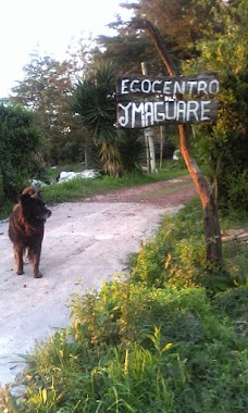
Ecocentro Imagüare
Paysandú
School
read more
11.25 km
Escuela N°57 Paysandú
Vizconde de Mauá, Paysandú
School
read more
11.299 km
Escuela De Tiempo Completo N 15
Paysandú
School
read more
13.829 km
Escuela Nro 7 San Francisco
Paysandú
School
read more
14.184 km
Escuela 36
Ruta 3 Gral José Artigas, Paysandú
School
read more
14.292 km
Liceo Francisco
Doctor Alberto D. Roldan (Vieja) 3245, Paysandú
School
read more
📑
all categories
Accounting
Administrative area level 1
Administrative area level 2
Airport
Amusement park
Aquarium
Art gallery
Atm
Bakery
Bank
Bar
Beauty salon
Bicycle store
Book store
Bowling alley
Bus station
Cafe
Campground
Car dealer
Car rental
Car repair
Car wash
Casino
Cemetery
Church
City hall
Clothing store
Colloquial area
Convenience store
Courthouse
Dentist
Department store
Doctor
Electrician
Electronics store
Embassy
Finance
Fire station
Florist
Food
Funeral home
Furniture store
Gas station
General contractor
Grocery or supermarket
Gym
Hair care
Hardware store
Health
Hindu Temple
Home goods store
Hospital
Insurance agency
Intersection
Jewelry store
Laundry
Lawyer
Library
Liquor store
Local government office
Locality
Locksmith
Lodging
Meal delivery
Meal takeaway
Mosque
Movie rental
Movie theater
Moving company
Museum
Natural feature
Neighborhood
Night club
Painter
Park
Parking
Pet store
Pharmacy
Physiotherapist
Place of worship
Plumber
Point of interest
Police
Political
Post office
Premise
Real estate agency
Restaurant
Roofing contractor
Route
Rv park, camping
School
Shoe store
Shopping mall
Spa
Stadium
Storage
Store
Subpremise
Supermarket
Synagogue
Taxi stand
Train station
Transit station
Travel agency
University
Veterinary care
Zoo
administrative area level 4
sublocality level 1
↑