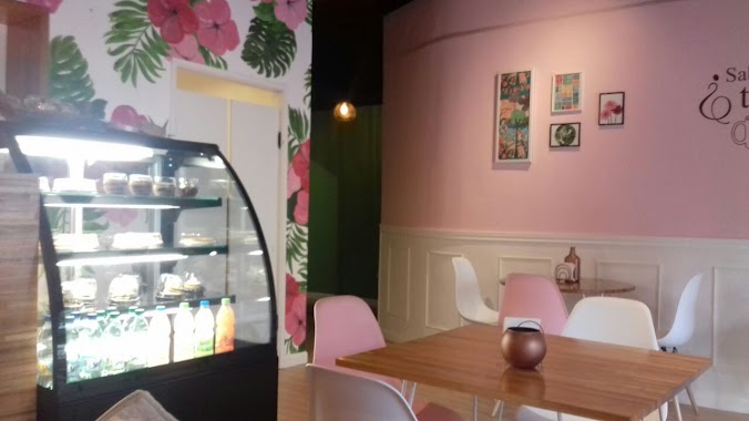
Cafe nearby Cine Parque Rodo
Uruguay
Cafe nearby Cine Parque Rodo
Cine Parque Rodo
Punta Carretas, Montevideo Uruguay
contacts phone
:
+598
Latitude:
-34.9159081
, Longitude:
-56.1680099
read more
nearest Cafe
350 m
The Lab Coffee Roasters • Museo Nacional de Artes Visuales
Montevideo
Cafe
read more
350 m
The lab coffee roasters museo artes visuales
Montevideo
Cafe
read more
431 m
Quiero Verte Casa De Te
Ibiray 2309, Montevideo
Cafe
read more
531 m
Café Latente
Maggiolo 542, Montevideo
Cafe
read more
534 m
Café Latente
Doctor Luis Piera 1919, Montevideo
Cafe
read more
548 m
Cybee Alfil
Pocitos, Montevideo
Cafe
read more
576 m
Cayetana
Ingeniero Carlos Ma. Maggiolo 499, Montevideo
Cafe
read more
777 m
ASTROBAR
Libertad 2436, Montevideo
Cafe
read more
790 m
Macoco Café
Doctor Pablo de María 1064, Montevideo
Cafe
read more
791 m
Confiteria Pellegrin
General Gregorio Suárez 2734
Cafe
read more
794 m
Beatniks Café
Juan Paullier 1064, Montevideo
Cafe
read more
841 m
DONUT CITY BAR
Luis Franzini 917, Montevideo
Cafe
read more
945 m
Coffee Shop
Bulevar España 2571, Montevideo
Cafe
read more
969 m
EMMA
21 de Setiembre 2745, Montevideo
Cafe
read more
970 m
Vaimaca Box Bar
21 de Setiembre 2741, Montevideo
Cafe
read more
1.005 km
Hemp-T Cafe
Doctor Héctor Miranda 2404, Montevideo
Cafe
read more
1.017 km
Sinestesia pocitos
José Benito Lamas 2725, Montevideo
Cafe
read more
1.053 km
Crepas - Creperia
Doctor Héctor Miranda 2427, Montevideo
Cafe
read more
1.066 km
La Esmeralda
11200, Juan Manuel Blanes 1248, Montevideo
Cafe
read more
1.113 km
Porto Vanila
Doctor Héctor Miranda 2361, Montevideo
Cafe
read more
1.13 km
Cafe Martinez
José Ellauri 499, Montevideo
Cafe
read more
1.134 km
ZAROS
José Ellauri 530, Montevideo
Cafe
read more
1.154 km
Marte Cafe y Arte
Carlos Ma. Maeso 2706, Montevideo
Cafe
read more
1.166 km
McCafé
Montevideo Shopping, Avenida Doctor Luis Alberto de Herrera 1290, Montevideo
Cafe
read more
1.254 km
La Gayola
José Ellauri 350, Montevideo
Cafe
read more
📑
all categories
Accounting
Administrative area level 1
Administrative area level 2
Airport
Amusement park
Aquarium
Art gallery
Atm
Bakery
Bank
Bar
Beauty salon
Bicycle store
Book store
Bowling alley
Bus station
Cafe
Campground
Car dealer
Car rental
Car repair
Car wash
Casino
Cemetery
Church
City hall
Clothing store
Colloquial area
Convenience store
Courthouse
Dentist
Department store
Doctor
Electrician
Electronics store
Embassy
Finance
Fire station
Florist
Food
Funeral home
Furniture store
Gas station
General contractor
Grocery or supermarket
Gym
Hair care
Hardware store
Health
Hindu Temple
Home goods store
Hospital
Insurance agency
Intersection
Jewelry store
Laundry
Lawyer
Library
Liquor store
Local government office
Locality
Locksmith
Lodging
Meal delivery
Meal takeaway
Mosque
Movie rental
Movie theater
Moving company
Museum
Natural feature
Neighborhood
Night club
Painter
Park
Parking
Pet store
Pharmacy
Physiotherapist
Place of worship
Plumber
Point of interest
Police
Political
Post office
Premise
Real estate agency
Restaurant
Roofing contractor
Route
Rv park, camping
School
Shoe store
Shopping mall
Spa
Stadium
Storage
Store
Subpremise
Supermarket
Synagogue
Taxi stand
Train station
Transit station
Travel agency
University
Veterinary care
Zoo
administrative area level 4
sublocality level 1
↑