Park nearby Cardenal Antonio María Barbieri
Uruguay
Park nearby Cardenal Antonio María Barbieri
Cardenal Antonio María Barbieri
Montevideo Uruguay
contacts phone
:
+598
Latitude:
-34.8747985
, Longitude:
-56.1825109
read more
nearest Park
1 m
Plaza del Reducto
Avenida General Garibaldi, Montevideo
Park
read more
497 m
La Figurita
Montevideo
Park
read more
591 m
Plaza Liber Falco
Montevideo
Park
read more
650 m
Plaza de las Misiones
Montevideo
Park
read more
722 m
Plaza Pedro Poveda
2960,, Enrique García Peña, Montevideo
Park
read more
781 m
Plaza Ex Terminal Goes
Goes, 11800, Montevideo
Park
read more
950 m
Cancha Rincon De Reducto.
Zapicán, Montevideo
Park
read more
1.349 km
Plazoleta Joaquín Suarez
Montevideo
Park
read more
1.368 km
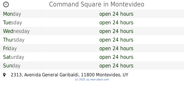
Command Square
Avenida General Garibaldi 2313, Montevideo
Park
read more
1.5 km
Plaza Barrial
Larrañaga, Montevideo
Park
read more
1.503 km
Cuaro 3179 AVENTURA PARK
Cuaro, Montevideo
Park
read more
1.529 km
Parque de las Esculturas
Montevideo
Park
read more
1.546 km
Plaza Miguel Ángel Pareja
Avenida Agraciada, Montevideo
Park
read more
1.586 km
Plaza Soldados Orientales de San Martín
Montevideo
Park
read more
1.631 km
Espacio Libre Carlos Real de Azúa
Carlos Solé, Montevideo
Park
read more
1.867 km
La Plaza
Altamirano, Montevideo
Park
read more
1.889 km
Plazoleta Jesús de Galíndez
Jesús de, Galindez, Montevideo
Park
read more
1.972 km
Plaza Francisco Araucho
Aguada, Montevideo
Park
read more
2.027 km
Plaza Antonio Barreiro Y Ramos
Montevideo
Park
read more
2.057 km
Plaza Sallé
Avenida Joaquín Suárez 2727, 11700, Montevideo
Park
read more
2.117 km
Plaza Budapest
Monte Caseros 2735, Montevideo
Park
read more
2.28 km
Fuente de las Garzas
Jardín Botánico, 19 De Abril, Montevideo
Park
read more
2.281 km
Espacio Pasaje La Vía
Acevedo Díaz 1932, Montevideo
Park
read more
2.29 km
Source Jardin Botanico
Avenida Doctor Alberto Boerger, Montevideo
Park
read more
2.377 km
Jardin Botánico De Montevideo
Avenida Doctor Luis Alberto de Herrera 4553, Montevideo
Park
read more
📑
all categories
Accounting
Administrative area level 1
Administrative area level 2
Airport
Amusement park
Aquarium
Art gallery
Atm
Bakery
Bank
Bar
Beauty salon
Bicycle store
Book store
Bowling alley
Bus station
Cafe
Campground
Car dealer
Car rental
Car repair
Car wash
Casino
Cemetery
Church
City hall
Clothing store
Colloquial area
Convenience store
Courthouse
Dentist
Department store
Doctor
Electrician
Electronics store
Embassy
Finance
Fire station
Florist
Food
Funeral home
Furniture store
Gas station
General contractor
Grocery or supermarket
Gym
Hair care
Hardware store
Health
Hindu Temple
Home goods store
Hospital
Insurance agency
Intersection
Jewelry store
Laundry
Lawyer
Library
Liquor store
Local government office
Locality
Locksmith
Lodging
Meal delivery
Meal takeaway
Mosque
Movie rental
Movie theater
Moving company
Museum
Natural feature
Neighborhood
Night club
Painter
Park
Parking
Pet store
Pharmacy
Physiotherapist
Place of worship
Plumber
Point of interest
Police
Political
Post office
Premise
Real estate agency
Restaurant
Roofing contractor
Route
Rv park, camping
School
Shoe store
Shopping mall
Spa
Stadium
Storage
Store
Subpremise
Supermarket
Synagogue
Taxi stand
Train station
Transit station
Travel agency
University
Veterinary care
Zoo
administrative area level 4
sublocality level 1
↑