School nearby Escuela De Tiempo Completo N 15
Uruguay
School nearby Escuela De Tiempo Completo N 15
Escuela De Tiempo Completo N 15
60000 Paysandú, Uruguay
contacts phone
:
+598 4723 3312
website:
www.cep.edu.uy
Latitude:
-32.295075
, Longitude:
-58.054318
larger map & directions
read more
nearest School
43 m
Escuela 15
Enrique Chaplin, Paysandú
School
read more
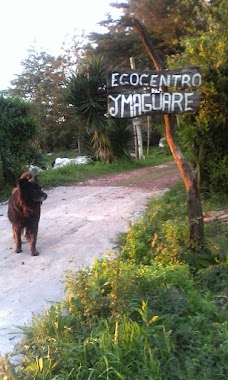
781 m
Ecocentro Imagüare
Paysandú
School
read more
1.529 km
Capilla de Fátima
Horacio Meriggi, Paysandú
School
read more
1.529 km
Fatima Chapel
Horacio Meriggi, Paysandú
School
read more
1.611 km
Mopi
Grito De Asencio 085, Paysandú
School
read more
1.744 km
Plaza J. C. Terra
Juncal 1662 60000, Paysandú
School
read more
1.78 km
Escuela Laureano Tacuabé
Grito De Asencio 085, Paysandú
School
read more
2.111 km
Escuela N°57 Paysandú
Vizconde de Mauá, Paysandú
School
read more
2.116 km
Escuela 111 Bario Norte
Republica de Venezuela, Paysandú
School
read more
2.135 km
Escuela 111
Paysandú
School
read more
2.321 km
Jardin De Infantes N° 103
Andresito 1218, Paysandú
School
read more
2.386 km
Escuela 4 Paysandu
1279, Coronel Lucas Píriz, Paysandú
School
read more
2.471 km
Escuela 88
Industrias, Paysandú
School
read more
2.528 km
Liceo Nº 8 Paysandú
Paysandú,60000
School
read more
2.571 km
Jardín de Mirta
820,, Cerrito, Paysandú
School
read more
2.571 km
Jardin lo de Mirta
Paysandú 820, Montevideo
School
read more
2.716 km
Escuela Nro 7 San Francisco
Paysandú
School
read more
3.234 km
Escuela 36
Ruta 3 Gral José Artigas, Paysandú
School
read more
3.239 km
Ilvem. Concentración. Lectura. Memoria.
Paysandú
School
read more
3.325 km
Our Kids Paysandú
1468,, Leandro Gomez, Paysandú
School
read more
3.35 km
Liceo Francisco
Doctor Alberto D. Roldan (Vieja) 3245, Paysandú
School
read more
3.535 km
ifd
Florida 1181, Paysandú
School
read more
3.617 km
Escuela 2
Sarandi, Paysandú
School
read more
3.621 km
Escuela Nro 2
Ituzaingo 1136, Paysandú
School
read more
3.653 km
Jardín Pibujitos
Paysandú 1029, Montevideo
School
read more
📑
all categories
Accounting
Administrative area level 1
Administrative area level 2
Airport
Amusement park
Aquarium
Art gallery
Atm
Bakery
Bank
Bar
Beauty salon
Bicycle store
Book store
Bowling alley
Bus station
Cafe
Campground
Car dealer
Car rental
Car repair
Car wash
Casino
Cemetery
Church
City hall
Clothing store
Colloquial area
Convenience store
Courthouse
Dentist
Department store
Doctor
Electrician
Electronics store
Embassy
Finance
Fire station
Florist
Food
Funeral home
Furniture store
Gas station
General contractor
Grocery or supermarket
Gym
Hair care
Hardware store
Health
Hindu Temple
Home goods store
Hospital
Insurance agency
Intersection
Jewelry store
Laundry
Lawyer
Library
Liquor store
Local government office
Locality
Locksmith
Lodging
Meal delivery
Meal takeaway
Mosque
Movie rental
Movie theater
Moving company
Museum
Natural feature
Neighborhood
Night club
Painter
Park
Parking
Pet store
Pharmacy
Physiotherapist
Place of worship
Plumber
Point of interest
Police
Political
Post office
Premise
Real estate agency
Restaurant
Roofing contractor
Route
Rv park, camping
School
Shoe store
Shopping mall
Spa
Stadium
Storage
Store
Subpremise
Supermarket
Synagogue
Taxi stand
Train station
Transit station
Travel agency
University
Veterinary care
Zoo
administrative area level 4
sublocality level 1
↑