School nearby Escuelas Nº54 y Nº55
Uruguay
School nearby Escuelas Nº54 y Nº55
Escuelas Nº54 y Nº55
Eduardo M. Castro, 55000, Artigas, UY Uruguay
contacts phone
:
+598
Latitude:
-30.4006406
, Longitude:
-56.4614148
larger map & directions
read more
nearest School
93 m
Clases Particulares Inglés Artigas
Eduardo M. Castro, Artigas
School
read more
157 m
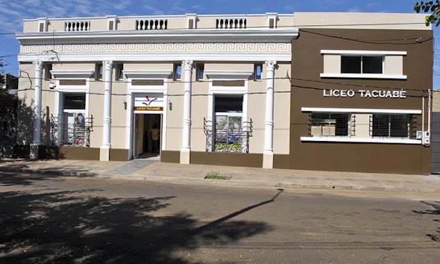
Liceo Tacuabé
Presidente Baldomir 482, Artigas
School
read more
283 m
Zumba Fitness Artigas
Avenida Lecueder, Artigas
School
read more
421 m
Escuela Figari
Bernabe Rivera 257, Artigas
School
read more
422 m
Jardin de Infantes No 72 Enriqueta Compte y Riqué
386,, 18 de Julio, Artigas
School
read more
435 m
instituto de formacion docente
Juan Antonio Lavalleja, Artigas
School
read more
448 m
Escuela N°78
Artigas
School
read more
450 m
Escuela Nº 71
Artigas
School
read more
479 m
Liceo Nº4
Artigas
School
read more
518 m
Escuela Artigas
Artigas
School
read more
523 m
Escuela España N2
Artigas
School
read more
542 m
Escuela Nº 1 y Nº 2
Doctor Luis Alberto de Herrera 357, Artigas
School
read more
565 m
Liceo Nº 2
Bernardina Fragoso de Rivera 356, Artigas
School
read more
611 m
Escuela 56 Eladio Dieste
Artigas
School
read more
611 m
Eladio Dieste school 56
Artigas
School
read more
761 m
Escuela De Samba Imperio Del Ayui
Artigas
School
read more
773 m
Gustavo Fernandez, Clases de Física y Matemática
Tomas Berreta 559, Artigas
School
read more
808 m
Concentración Escuelas de Samba Carnaval
Artigas
School
read more
892 m
Colegio Juan Pablo II
Avenida Cnel. Carlos Lecueder, Artigas
School
read more
911 m
Liceo Nº1
General Eugenio Garzón 594, Artigas
School
read more
955 m
Cuadra de ensayo de Escuela de Samba Barrio Rampla
Blandengues, Artigas
School
read more
989 m
Escuela N°43
Amaro F. Ramos, Artigas
School
read more
1.058 km
Tacuabé
Garzón
School
read more
1.079 km
CAIF Camalote
Artigas
School
read more
1.153 km
School # 37, Baron of Rio Branco
Avenida Cnel. Carlos Lecueder 740, Artigas
School
read more
📑
all categories
Accounting
Administrative area level 1
Administrative area level 2
Airport
Amusement park
Aquarium
Art gallery
Atm
Bakery
Bank
Bar
Beauty salon
Bicycle store
Book store
Bowling alley
Bus station
Cafe
Campground
Car dealer
Car rental
Car repair
Car wash
Casino
Cemetery
Church
City hall
Clothing store
Colloquial area
Convenience store
Courthouse
Dentist
Department store
Doctor
Electrician
Electronics store
Embassy
Finance
Fire station
Florist
Food
Funeral home
Furniture store
Gas station
General contractor
Grocery or supermarket
Gym
Hair care
Hardware store
Health
Hindu Temple
Home goods store
Hospital
Insurance agency
Intersection
Jewelry store
Laundry
Lawyer
Library
Liquor store
Local government office
Locality
Locksmith
Lodging
Meal delivery
Meal takeaway
Mosque
Movie rental
Movie theater
Moving company
Museum
Natural feature
Neighborhood
Night club
Painter
Park
Parking
Pet store
Pharmacy
Physiotherapist
Place of worship
Plumber
Point of interest
Police
Political
Post office
Premise
Real estate agency
Restaurant
Roofing contractor
Route
Rv park, camping
School
Shoe store
Shopping mall
Spa
Stadium
Storage
Store
Subpremise
Supermarket
Synagogue
Taxi stand
Train station
Transit station
Travel agency
University
Veterinary care
Zoo
administrative area level 4
sublocality level 1
↑