Park nearby Plaza VISTA LINDA
Uruguay
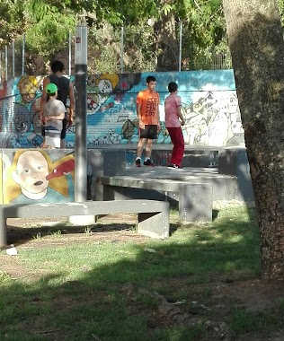
Park nearby Plaza VISTA LINDA
Plaza VISTA LINDA
Calle 8 de 17 Metros, Montevideo Uruguay
contacts phone
:
+598
Latitude:
-34.8434295
, Longitude:
-56.1087805
read more
nearest Park
1.611 km
Plaza Alba Roballo
Montevideo
Park
read more
1.659 km
Arroyo Chacarita
Montevideo
Park
read more
1.906 km
Club Baby Fútbol Parque Guaraní
Itapeby, Montevideo
Park
read more
1.943 km
Plaza del Parque Guaraní
Montevideo
Park
read more
2.104 km
Danubio
Osvaldo Cruz 5533, Montevideo
Park
read more
2.143 km
Grinor Cno.oncativo
Montevideo
Park
read more
2.225 km
Plaza Museo Memoria de Punta de Rieles
Cno. Maldonado, Camino Guerra, Montevideo
Park
read more
2.291 km
Plaza Don Tico
Montevideo
Park
read more
2.561 km
Intercambiador Belloni
Avenida José Belloni, Montevideo
Park
read more
3.389 km
Espacio Libre Ruben M. Viera
Avenida José Belloni 4386, Montevideo
Park
read more
3.581 km
Skatepark Plaza 5
Montevideo
Park
read more
3.607 km
César Díaz Park
Gral. José Villagrán, José Antonio Cabrera y, 20 de Febrero, Montevideo
Park
read more
3.607 km
Parque César Díaz
Gral. José Villagrán, José Antonio Cabrera y, 20 de Febrero, Montevideo
Park
read more
3.834 km
Skatepark Ituzaingó
Montevideo
Park
read more
4.389 km
Patio Facultad De Ciencias
Montevideo
Park
read more
4.912 km
Espacio Libre Yuri Gagarin
Montevideo
Park
read more
5.231 km
Plaza Ing. Álvarez Cortés
Juan Pedro Beranger 7383, Montevideo
Park
read more
5.391 km
Parque Colegio Jesús María
Montevideo
Park
read more
5.408 km
Ivana perros
Constancio C. Vigil, Montevideo
Park
read more
5.522 km
Plaza Mateo Vidal
Ignacio Núñez, Montevideo
Park
read more
5.699 km
Parque Renacer
Montevideo
Park
read more
5.803 km
La Plaza
Altamirano, Montevideo
Park
read more
5.837 km
COVIUN
Ing. Alvaro Correa Moreno, Montevideo
Park
read more
6.158 km
Espacio Libre Raul Feldman
Montevideo
Park
read more
6.518 km
Plaza Joaquin Secco Illa
Doctor Joaquín Secco Illa, Montevideo
Park
read more
📑
all categories
Accounting
Administrative area level 1
Administrative area level 2
Airport
Amusement park
Aquarium
Art gallery
Atm
Bakery
Bank
Bar
Beauty salon
Bicycle store
Book store
Bowling alley
Bus station
Cafe
Campground
Car dealer
Car rental
Car repair
Car wash
Casino
Cemetery
Church
City hall
Clothing store
Colloquial area
Convenience store
Courthouse
Dentist
Department store
Doctor
Electrician
Electronics store
Embassy
Finance
Fire station
Florist
Food
Funeral home
Furniture store
Gas station
General contractor
Grocery or supermarket
Gym
Hair care
Hardware store
Health
Hindu Temple
Home goods store
Hospital
Insurance agency
Intersection
Jewelry store
Laundry
Lawyer
Library
Liquor store
Local government office
Locality
Locksmith
Lodging
Meal delivery
Meal takeaway
Mosque
Movie rental
Movie theater
Moving company
Museum
Natural feature
Neighborhood
Night club
Painter
Park
Parking
Pet store
Pharmacy
Physiotherapist
Place of worship
Plumber
Point of interest
Police
Political
Post office
Premise
Real estate agency
Restaurant
Roofing contractor
Route
Rv park, camping
School
Shoe store
Shopping mall
Spa
Stadium
Storage
Store
Subpremise
Supermarket
Synagogue
Taxi stand
Train station
Transit station
Travel agency
University
Veterinary care
Zoo
administrative area level 4
sublocality level 1
↑